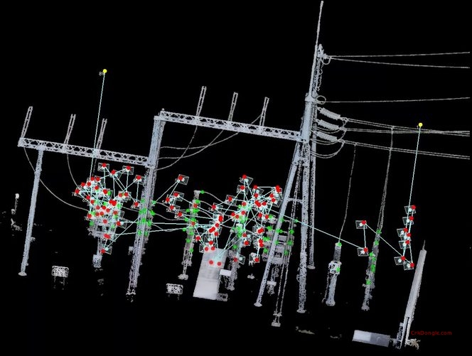
LiPowerline 9.1 is the intelligent power line inspection software developed by GreenValley International. Built on advanced LiDAR point cloud processing technology, it provides comprehensive solutions for power transmission and distribution line asset management, vegetation encroachment detection, and defect identification from UAV, airborne, and terrestrial LiDAR data.
What’s New in LiPowerline 9.1
Enhanced Power Line Asset Extraction
Improved automatic power line extraction algorithms for more accurate conductor, tower, and insulator identification from complex point cloud datasets. Faster processing with reduced manual intervention.
Advanced Defect Detection
-
Conductor sag and tension analysis with automatic anomaly flagging
-
Tower tilt and deformation measurement with millimeter-level accuracy
-
Insulator damage and missing component detection using AI-powered classification
-
Corona discharge risk assessment based on conductor geometry and spacing
Vegetation Management
-
Tree encroachment analysis with automatic clearance violation detection
-
Tree growth prediction models for proactive vegetation management planning
-
Trimming priority ranking based on proximity to conductors and risk assessment
Multi-Platform Data Support
-
Enhanced support for UAV LiDAR, airborne LiDAR, and terrestrial laser scanning data
-
Improved multi-return point cloud processing for dense vegetation penetration
-
Colorized point clouds from integrated RGB cameras for visual verification
Reporting & Integration
-
Automated inspection reports with defect locations, measurements, and severity ratings
-
GIS integration for seamless data export to utility asset management systems
-
PLS-CADD compatible output for engineering analysis and design verification
Core Features
LiDAR Data Processing
Import and process point cloud data from all major LiDAR sensors including DJI, RIEGL, Velodyne, and Leica. Automatic ground classification, noise filtering, and point cloud normalization for optimal power line feature extraction.
Power Line Modeling
Automatic 3D modeling of transmission and distribution lines including conductors, ground wires, towers, poles, and hardware components. Support for single-circuit, double-circuit, and multi-voltage configurations.
Clearance Analysis
Calculate vertical, horizontal, and diagonal clearances between conductors and ground, vegetation, buildings, roads, and other infrastructure. Automatic identification of code violations per IEEE, NESC, and local standards.
Thermal Rating Analysis
Estimate conductor thermal ratings based on ambient temperature, wind speed, and solar radiation data. Predict ampacity and identify potential overload conditions.
Structural Assessment
Tower and pole structural health evaluation including tilt, twist, foundation settlement, and guy wire tension analysis. Compare as-built conditions against design specifications.
Corridor Mapping
Comprehensive right-of-way mapping with terrain profiling, crossing identification, and encroachment documentation. Support for corridor width analysis and easement verification.
3D Visualization & Animation
Interactive 3D environment for point cloud visualization, model inspection, and fly-through animation creation. Cross-sectional views and profile extraction for detailed engineering review.