CoProcess 2.7.2 is the latest iteration of CHCNAV’s advanced post-processing software for LiDAR point cloud data, released in January 2025 as part of the CoProcess series (building on the initial launch in early 2024). Developed by CHC Navigation (CHCNAV), a global leader in GNSS and geospatial solutions, it specializes in transforming raw LiDAR scans from UAVs, mobile mapping systems, and terrestrial scanners into actionable deliverables like DEMs (Digital Elevation Models), DSMs (Digital Surface Models), 3D models, and feature extractions. The software is tailored for surveying, mapping, civil engineering, and construction professionals, offering automated classification and analysis to handle massive datasets (e.g., billions of points) efficiently. It integrates seamlessly with tools like AutoCAD, ArcGIS, and Leica Cyclone, reducing manual workflows and improving accuracy for applications such as terrain modeling, road design, and volume calculations.
This version emphasizes enhanced automation, UI refinements, and export flexibility, making it suitable for large-scale projects like infrastructure development or environmental monitoring. CoProcess stands out for its balance of power and usability, with processing speeds up to 10x faster than traditional methods for datasets over 10 GB.
Key Features of CoProcess 2.7.2
- Point Cloud Processing: Advanced noise filtering, ground/vegetation classification, and clustering for clean data preparation.
- Feature Extraction: Automated/manual tools for roads, buildings (contours, doors, windows), power lines, and stockpiles.
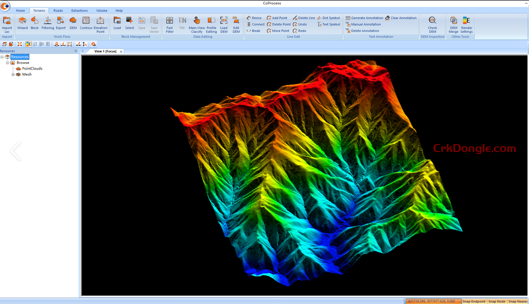
- Modeling Tools: DEM/DSM generation, contour lines, road surface modeling, and 3D scene reconstruction.
- Analysis Modules: Volume calculations (grid method), elevation verification with checkpoints, and area/distance measurements.
- Export Options: DXF, SHP, DAT, DEM, IFC, and 3D models for CAD/BIM integration.
- User Interface: Customizable docking layout, workflow wizards, and CoData format for fast import/visualization.